Anatolia has deep roots in human history, for it is here at Göbekli Tepe in Southeast Turkey, that we see the first signs of the domestication of grains around 12,000 years ago, but we began our journey in the Highlands of Armenia and ended it on the Aegean at the north of the Meander River, nearly 3,000kms later!
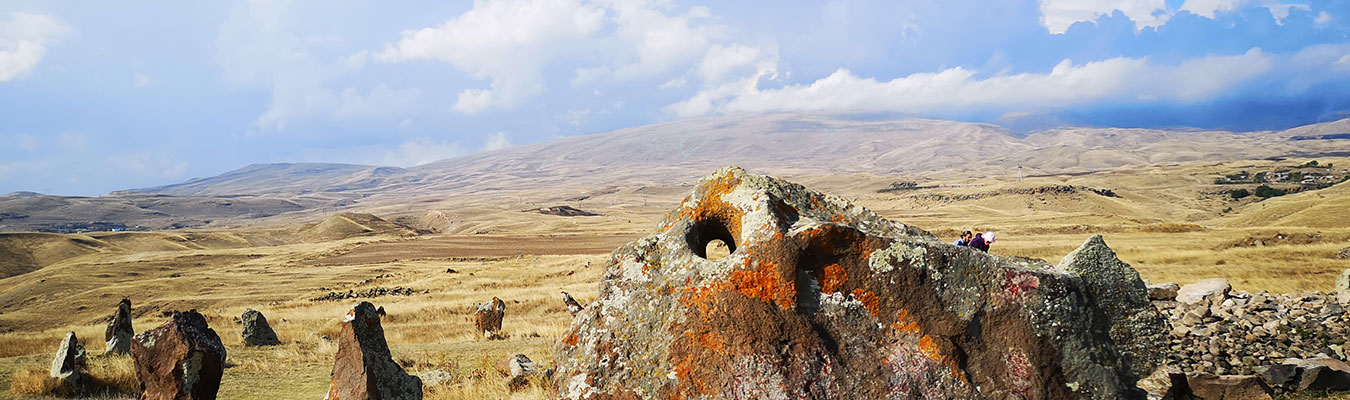
We started with a precipitous journey in a 4×4 along a mountain trail to see the Ughtasar petroglyphs. Situated in a volcanic basin, with a glacial lake, at over 3,000 metres. The basin, in front of the lake is littered with hundreds of petroglyphs, depicting hunting and pastoral scenes as well as enigmatic symbols which can be seen repeated all the way across Anatolia to the Aegean. The petroglyphs at Ughtasar date from about 12,000 to 6,000 BC and are a wonder. From the heights of Ughtasar we descended to the valley below and the standing stone complex of Karahunj, which is believed to date back to around 7,500 BC. From here we went back north to visit a Neolithic star map in the mountains on the slopes of Mount Sevsar. Our last stop in Armenia was the truly jaw-dropping standing stones at Hartashen. This stone complex simply defies explanation, simply put, nobody knows what it is. Dating back at least 6,000 years the site comprises two avenues of stones, approximately 300 metres each and comprising three rows each, set at an angle to each other. We’ll have to let the pictures speak for themselves on this one. Feel free to give us any suggestions.
Part 2 of our adventure is here for you to read. It has been an amazing journey and one that has forged deeper links and friendships.